QH sử dụng đất Lai Châu
sdđ-lai-châu


About App
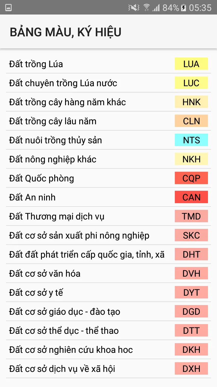
- Support to look up the land use planning of Muong Te, SAI HO, THAN UYEN - Use Mapbox.com basemap technology on published land use plans - Determine the user's current location on land use planning maps - Using 02 coordinate systems of Longitude, Latitude and coordinate system VN2000 - Support map zoom function, rotate Map along North-South axis - Find and mark current location by name - Electronic compass (supports only devices with magnetic sensors) - Support to customize the transfer calcula
Developer info