Geolantis.360
geolantis.360
About App
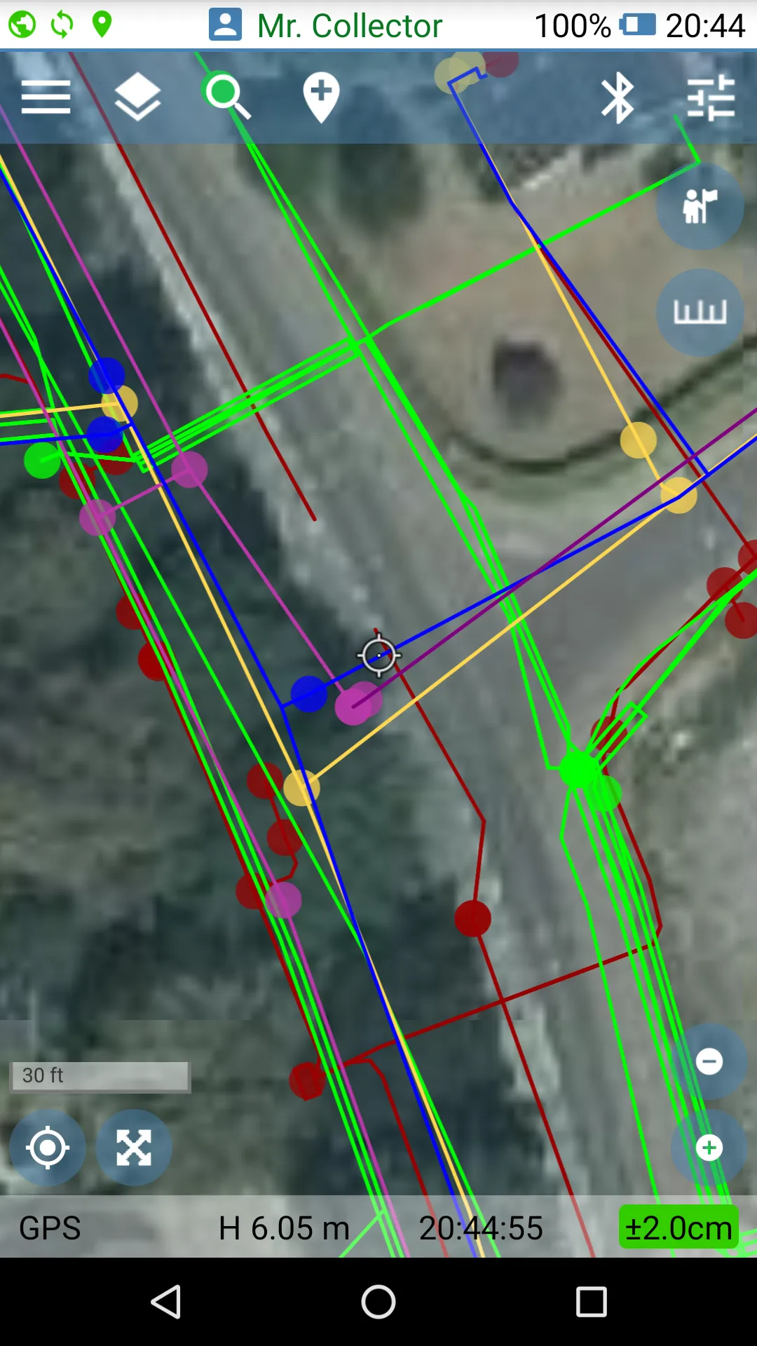
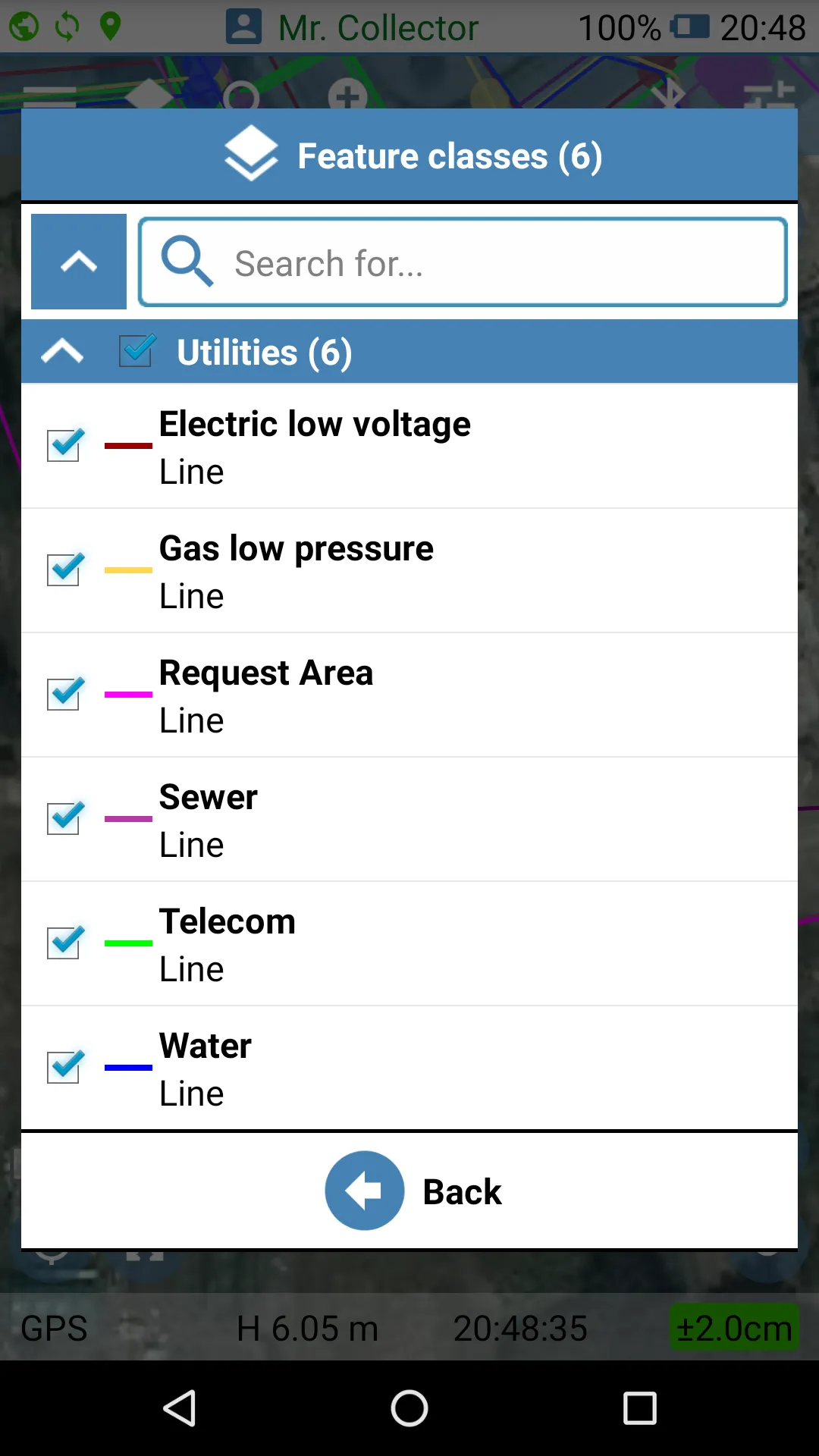
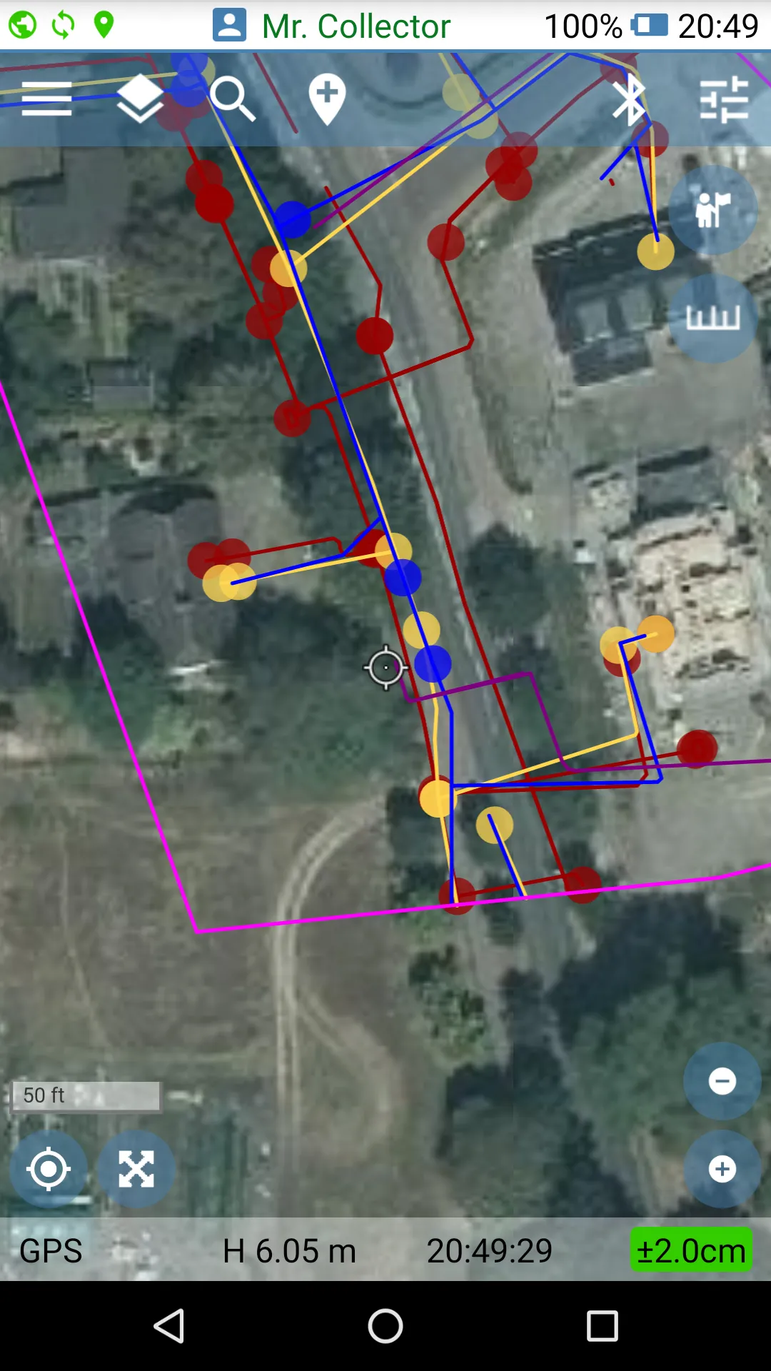
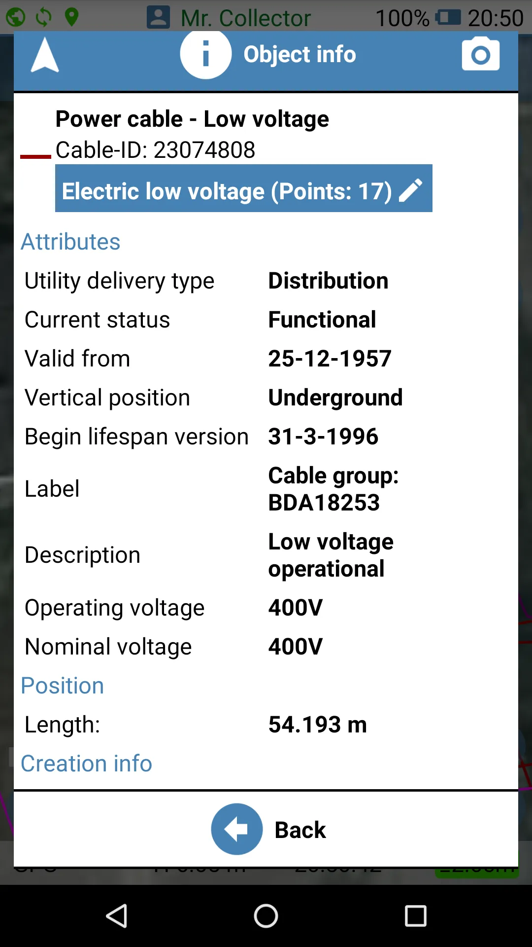
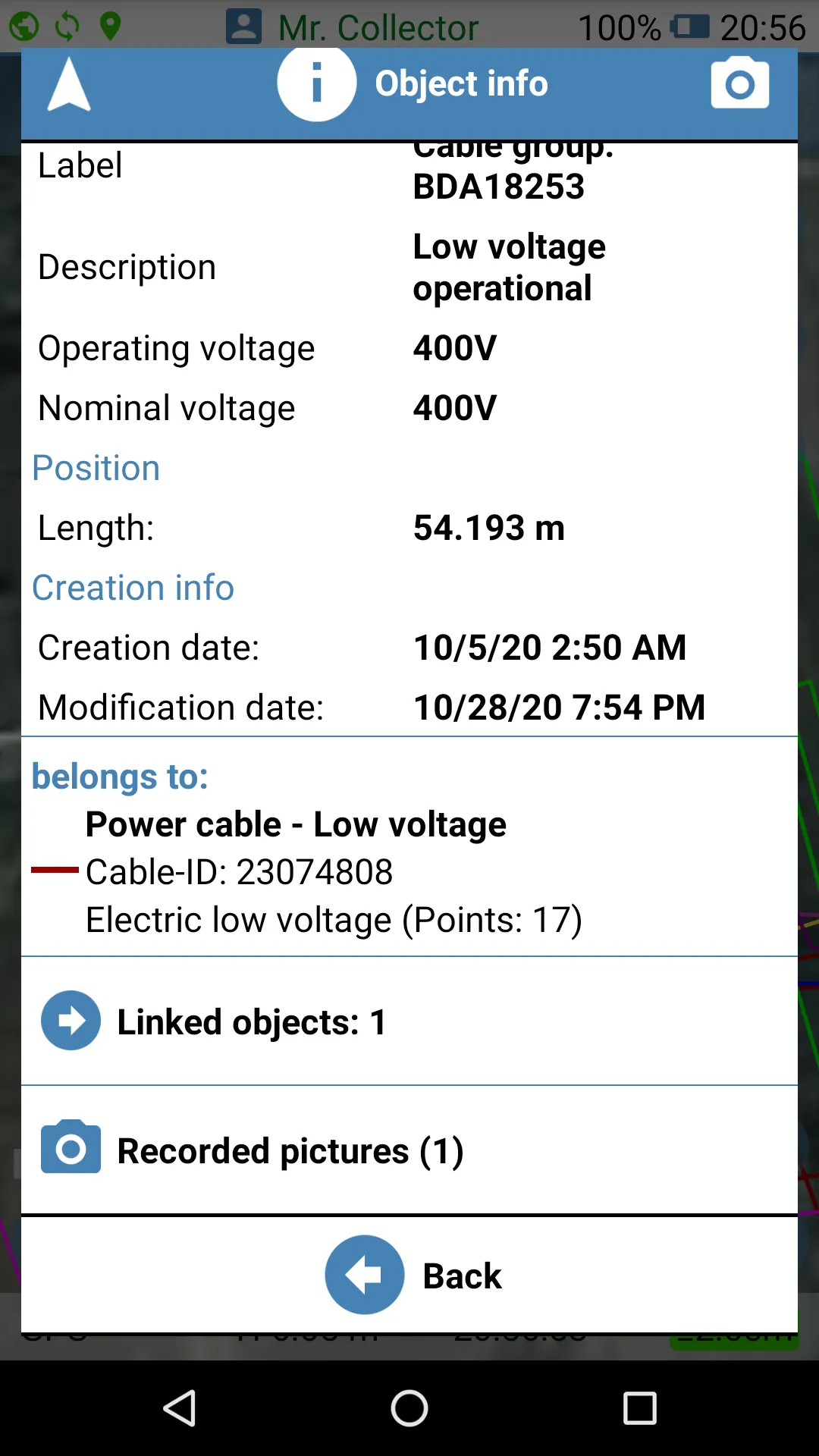
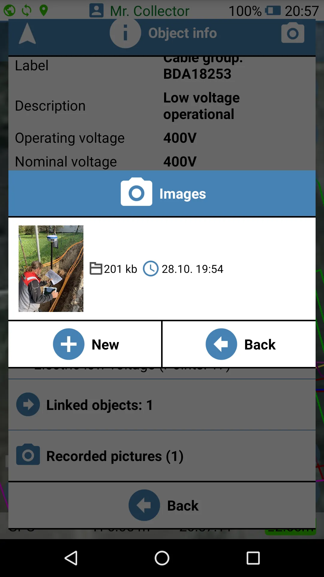
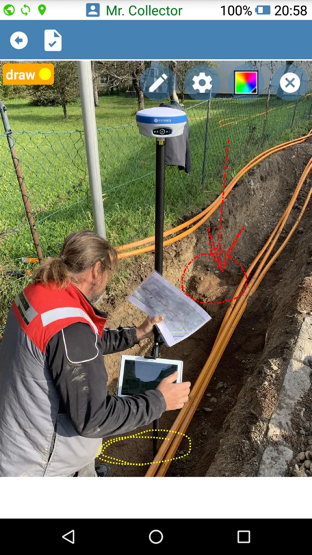
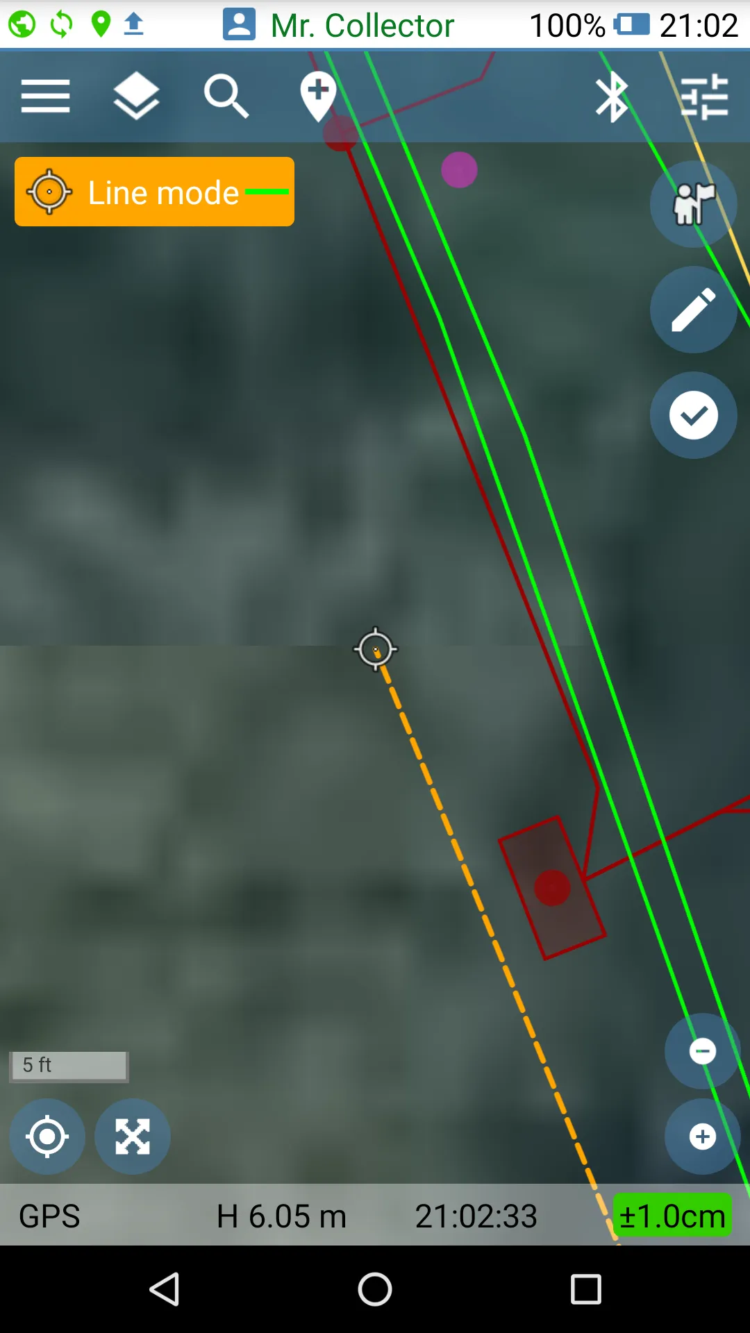
Geolantis.360 is an advanced GPS software for professional field operators who need to collect accurate information of assets, utilities and other location related information. The mobile Geolantis app allows a field worker to visualize their position relative to existing infrastructure, access attached project documents or photos and gives the ability to update location coordinates. In addition, Geolantis supports taking geo-referenced photos, filling electronic forms and creating field notes
Developer info