Drone Surveyor (for DJI)
drone-surveyor
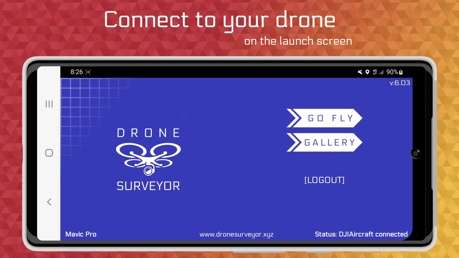
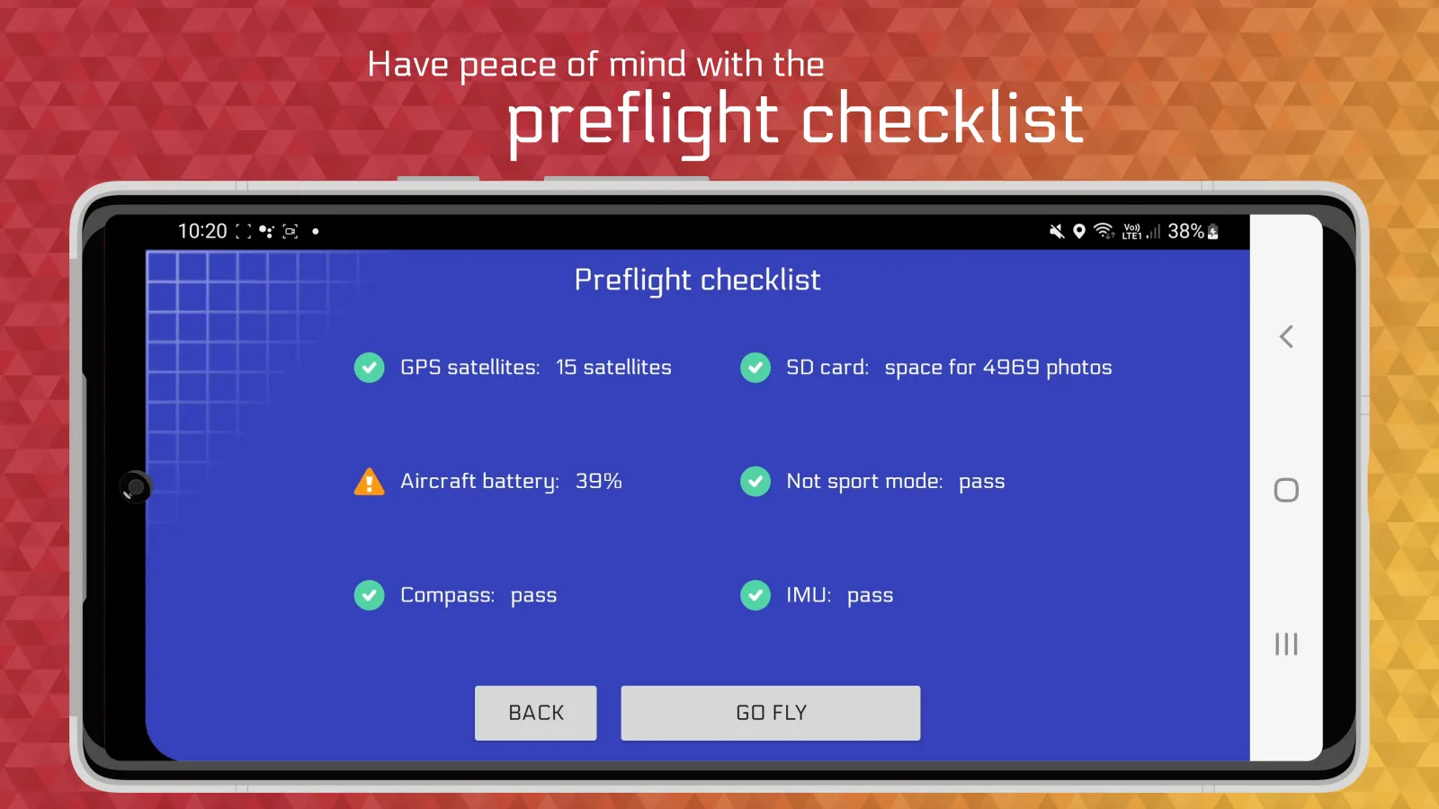
About App
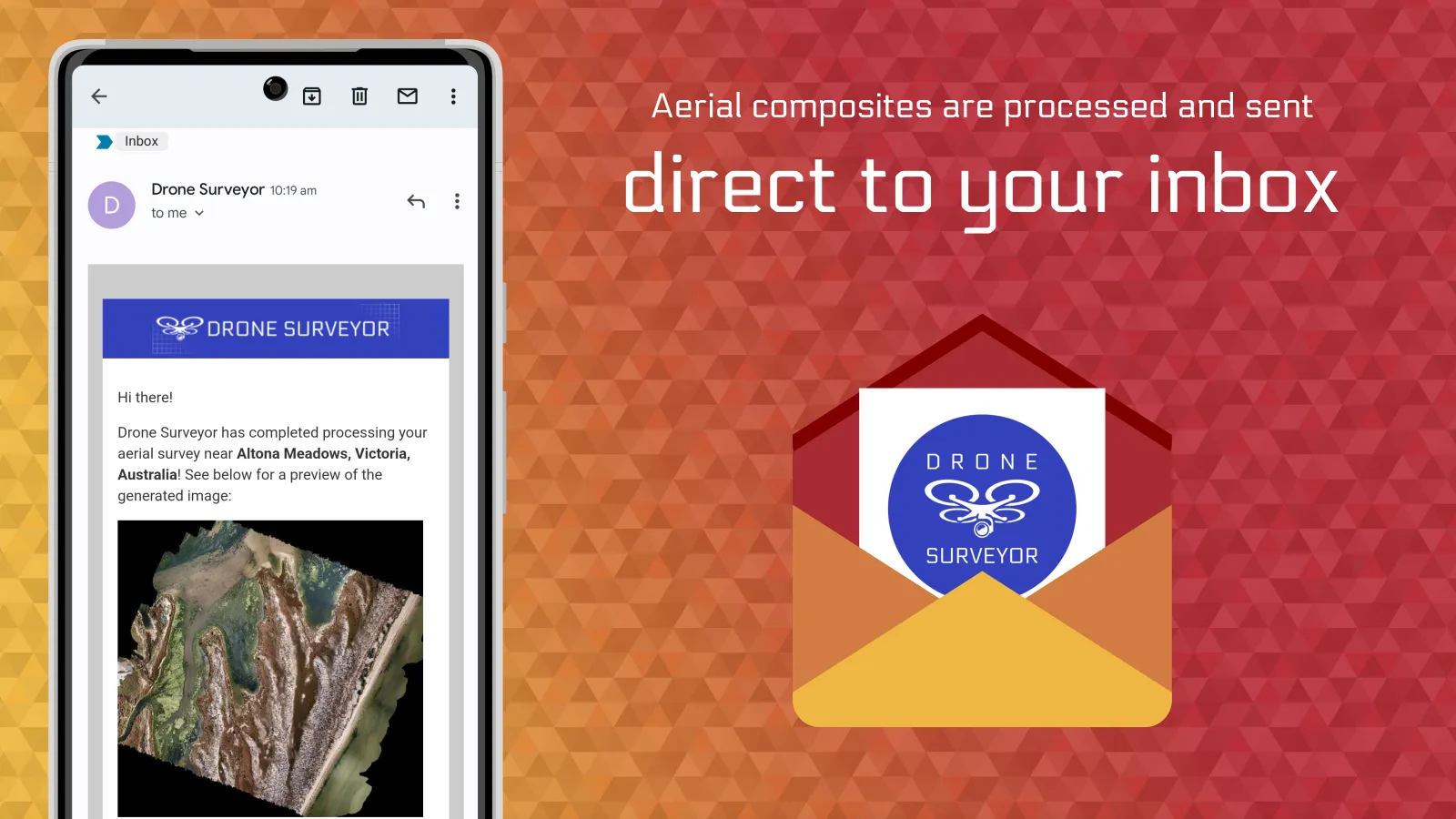
The Drone Surveyor app has been designed to be used by drone pilots that need to obtain high resolution aerial composites. It’s a cheap option, especially if the drone pilot already has the equipment. The Drone Surveyor app is a great app to have in any drone pilots’ arsenal.
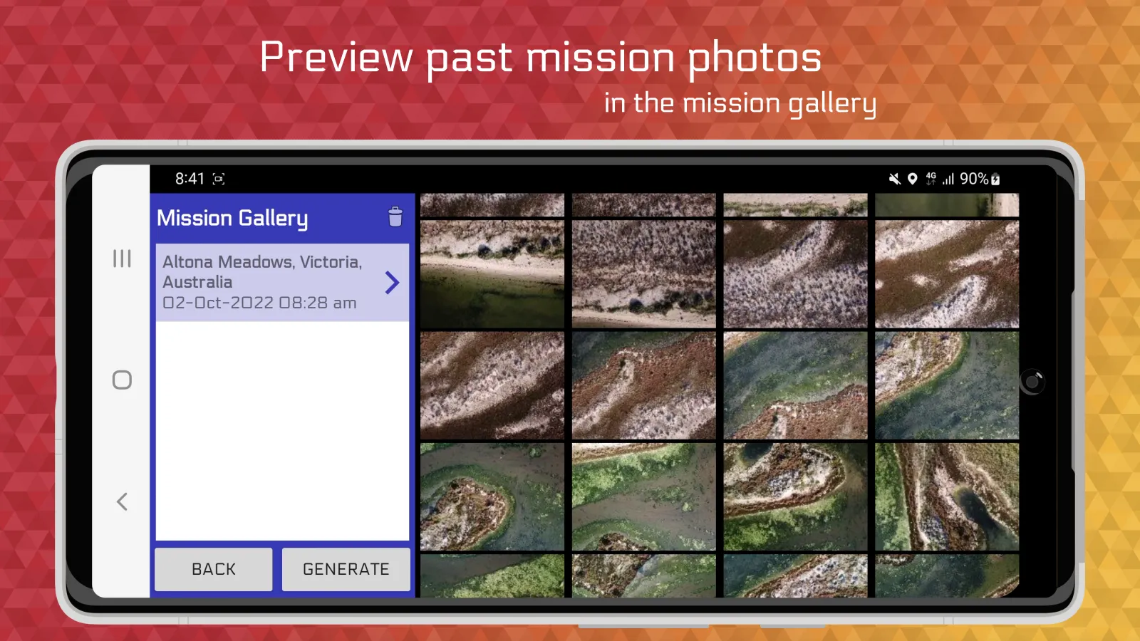
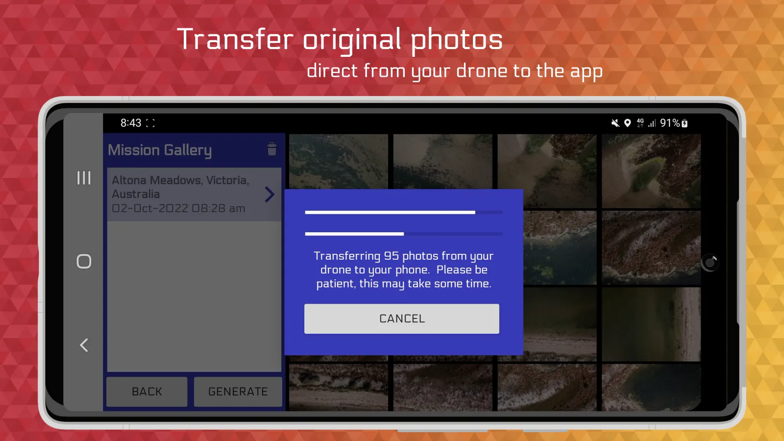
What can you do with Drone Surveyor?
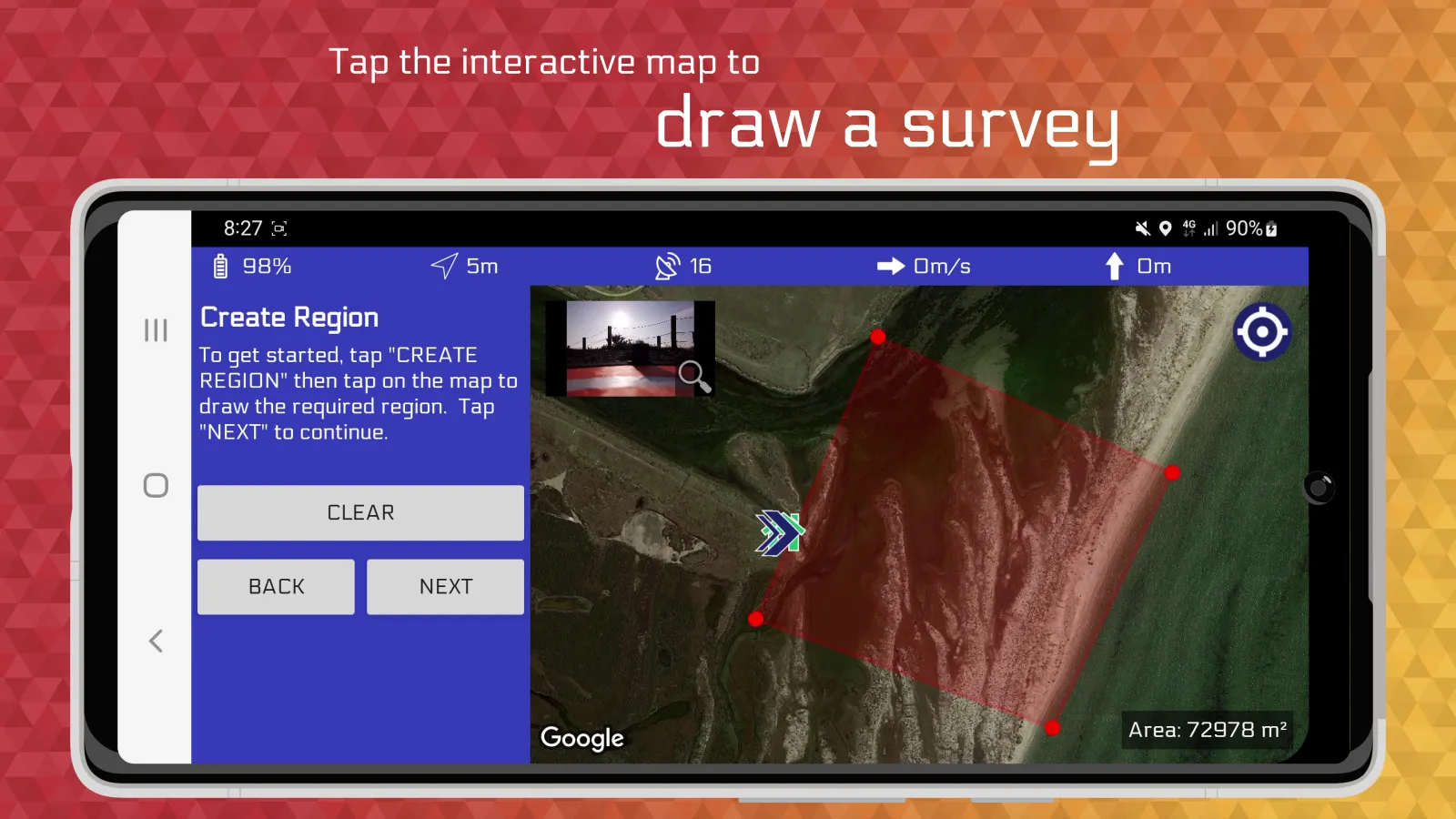
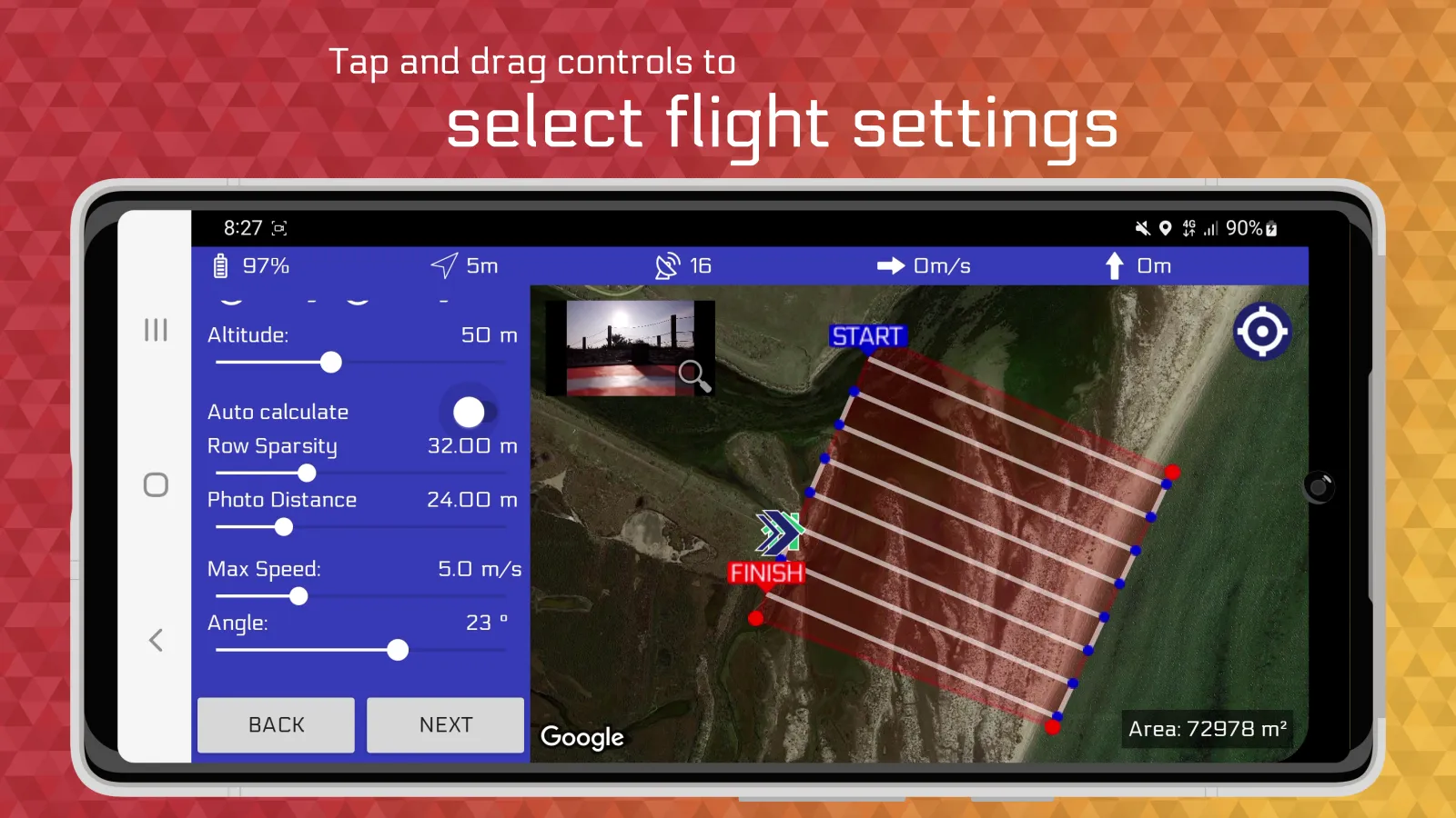
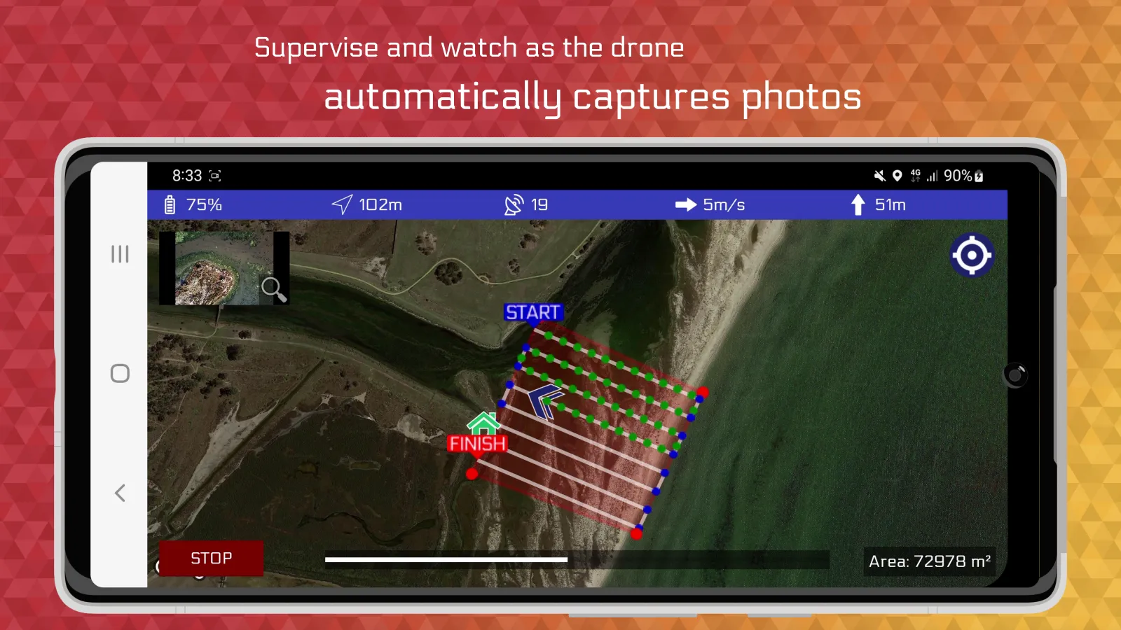
- You can draw a region on the map of where you'd like to scan. The drone with fly back and forwards with the camera facing the ground taking photos.
Developer info