Swiss Drone Maps
drone-maps
About App
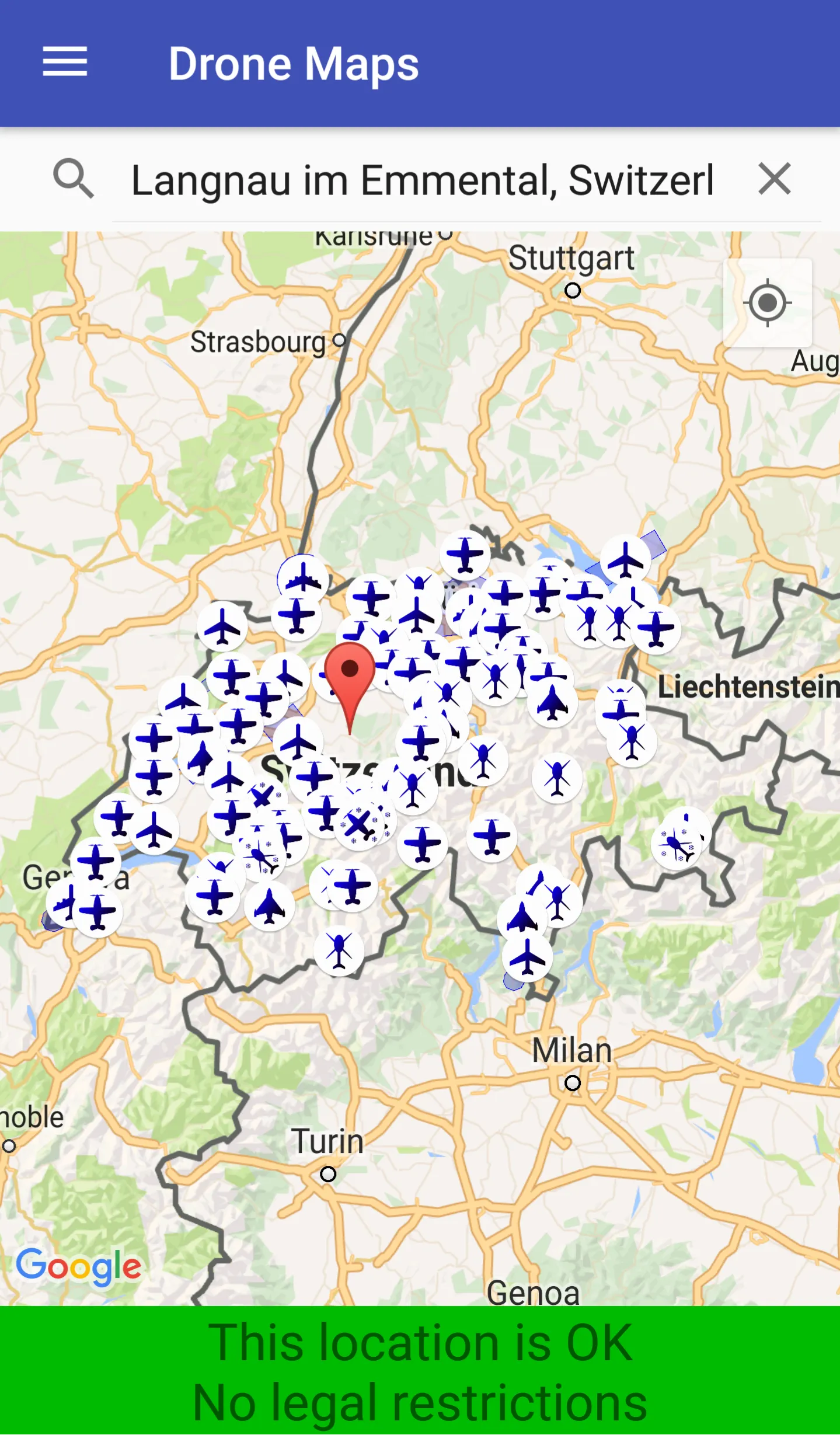
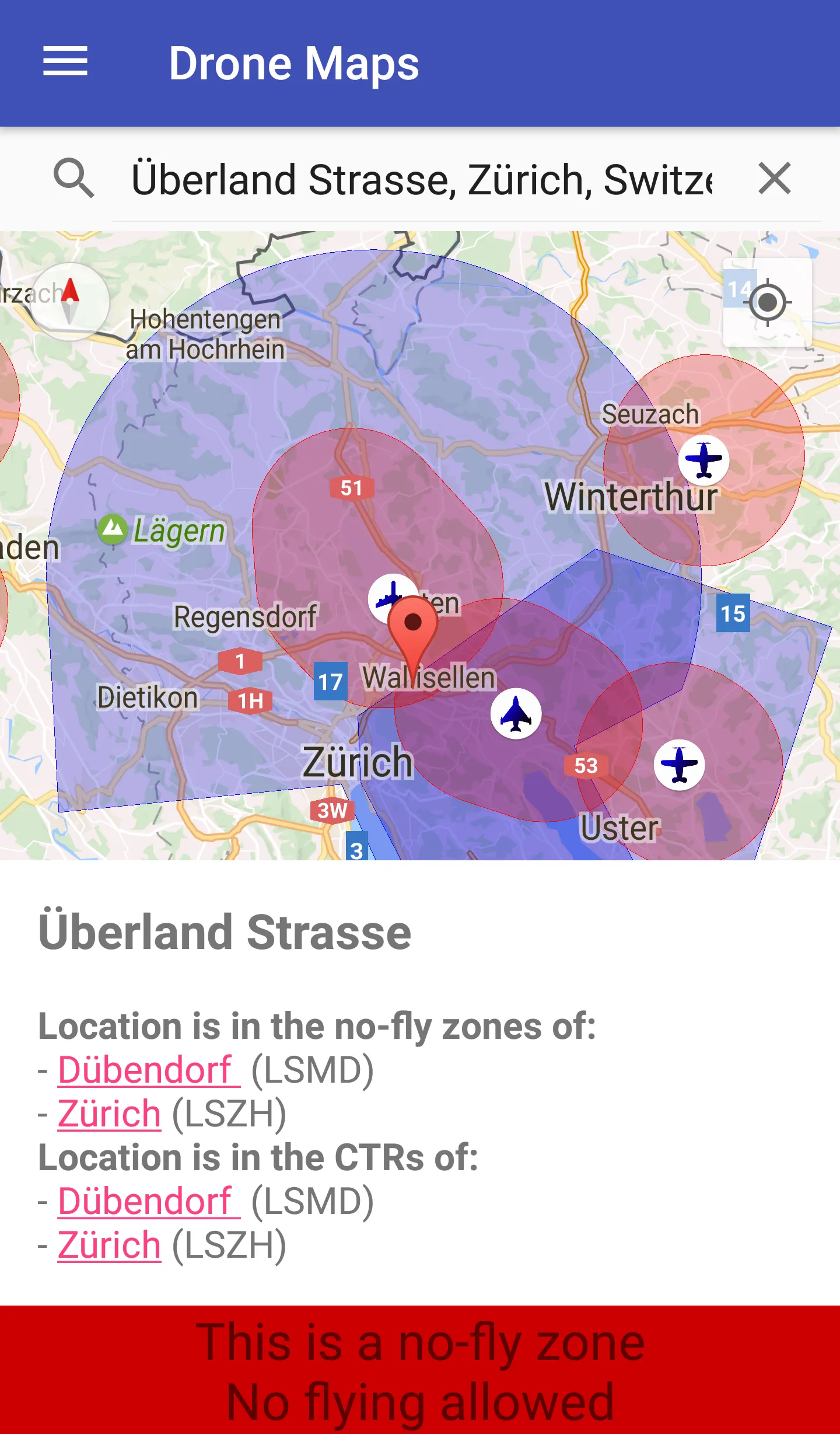
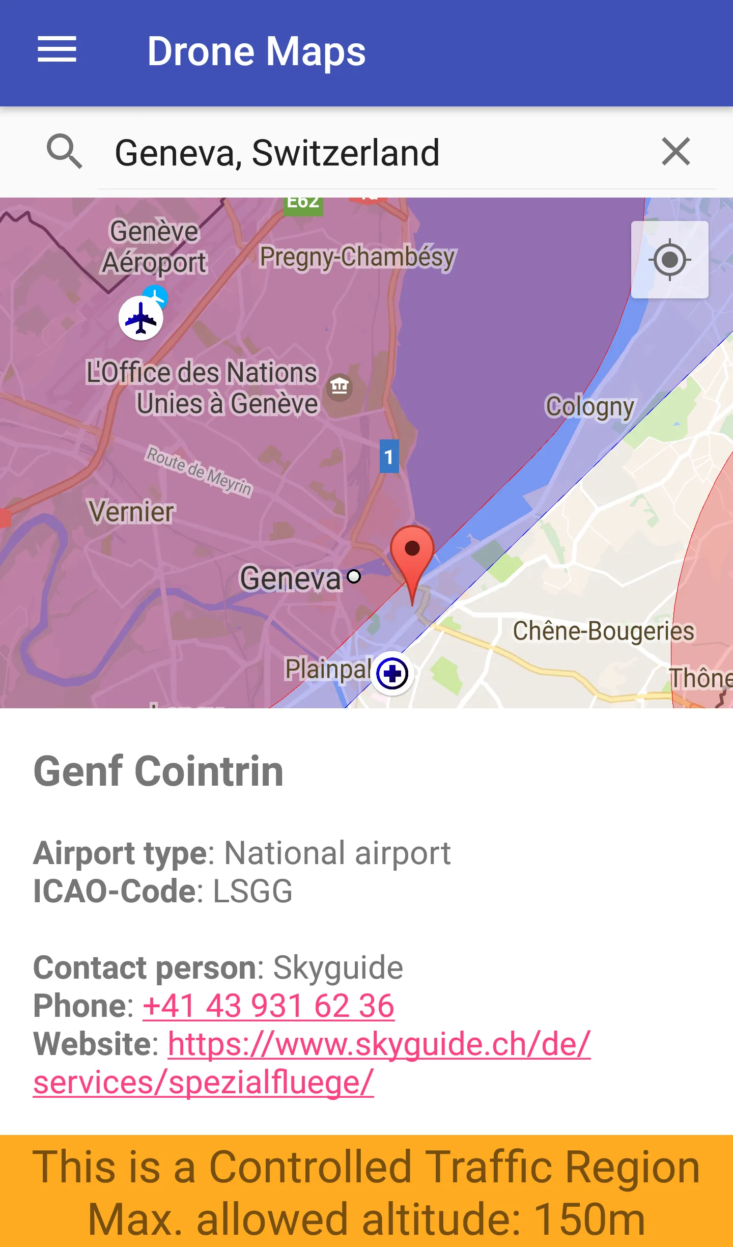
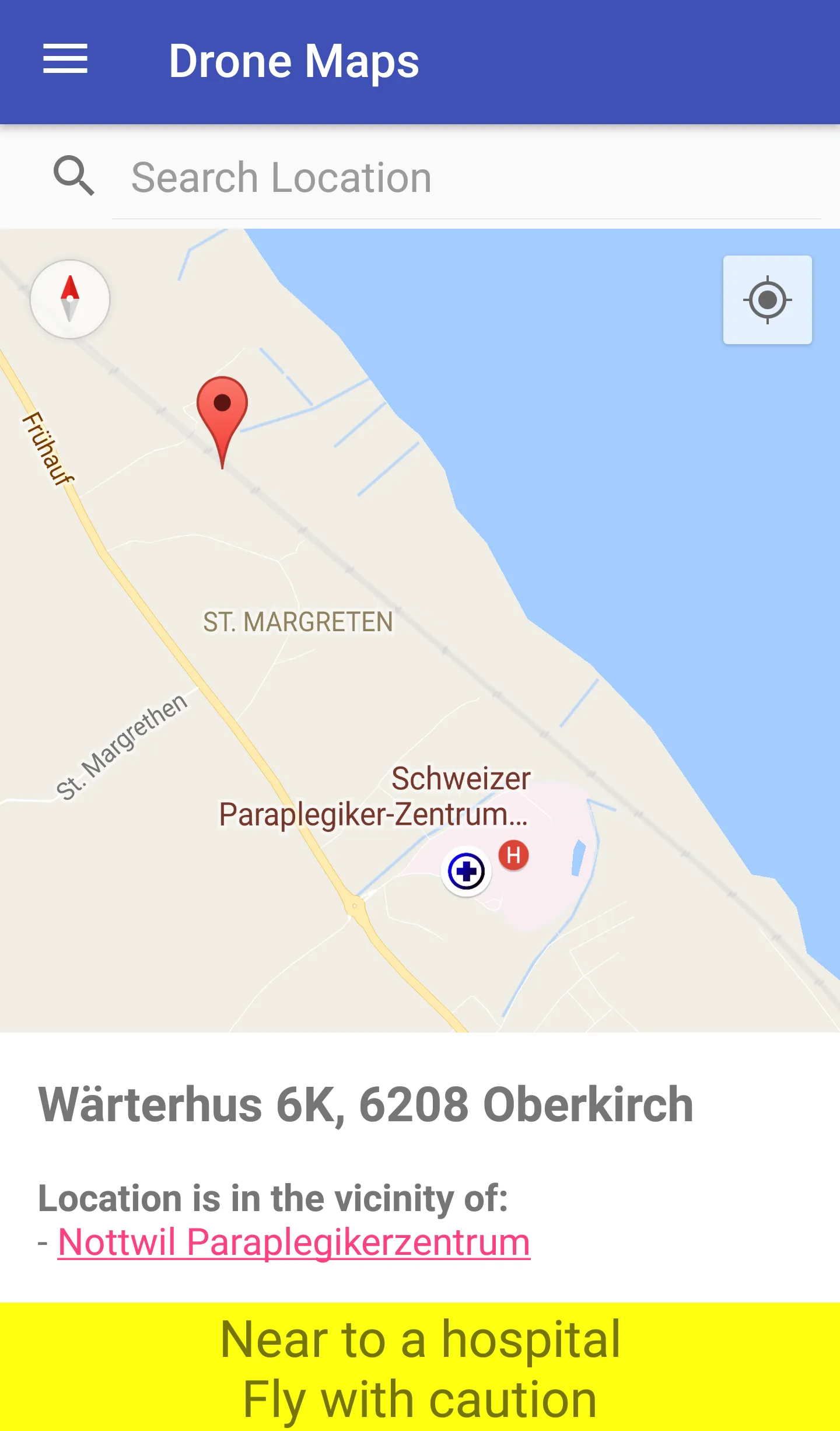
Pilots of drones and model airplanes can use Swiss Drone Maps to catch up on where they are allowed to fly. No-fly zones and controlled traffic regions are specifically coloured on the map and therefore easily visible. Airports and heliports are clearly visible thanks to intuitive markers on the map. At higher zoom levels, the map shows relevant additional information such as hospital and mountain airfields. The selection of a site marker shows not only information about the area but also the p
Developer info