GA Flight Tracker
ga-flight-tracker


About App
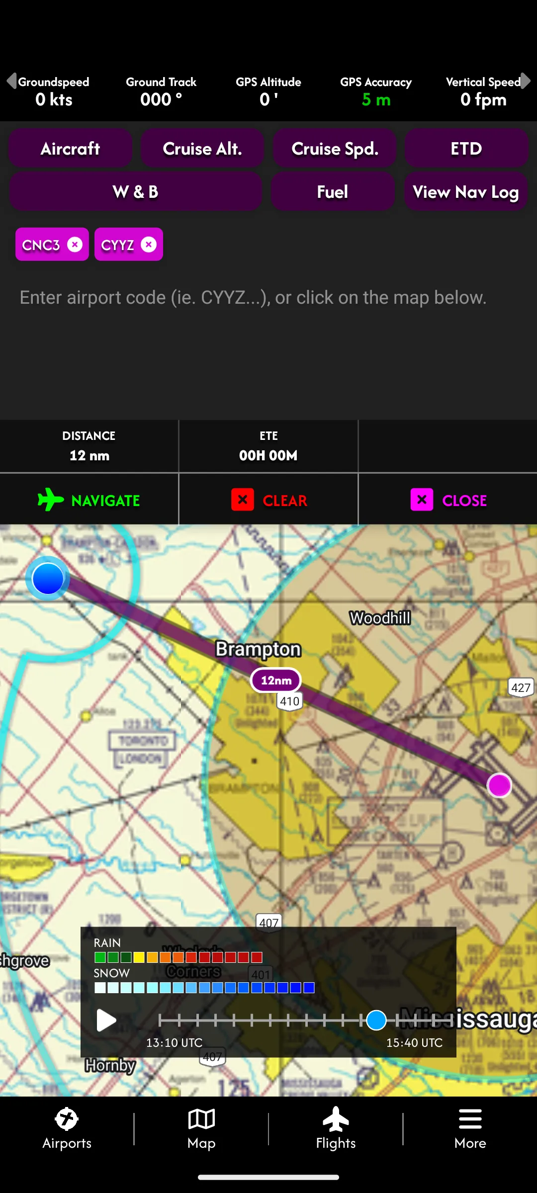
The Ultimate Pilot Navigation & Safety Companion Take to the skies with General Aviation Flight Tracker, the all-in-one app designed to make every flight safer, more efficient, and stress-free. Whether you're a seasoned pilot or a passionate aviation enthusiast, this app brings cutting-edge tools to your fingertips, even when you're offline. Key Features to Elevate Your Flying Experience: Inline Flight Planning Plan your journey seamlessly with tools designed for precision and simplicity. Flig
Developer info