TdhZonesC
tdhzones_c
About App
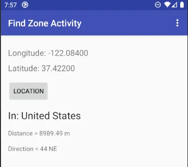
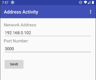
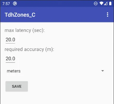
TdhZones reports location relative to defined polygons (geofencing) using coordinates obtained from the device on which the app is running. Polygons used by TdhZones are defined within an sqlite database that may be created, viewed and edited using the TdhGIS personal computer software. Coordinates used by the polygons may be longitude/latitude or any coordinates that can be obtained by converting from long/lat data using the Proj4 library. A typical use of TdhZones would be determining the name
Developer info