Cartes IGN
cartes-ign
About App
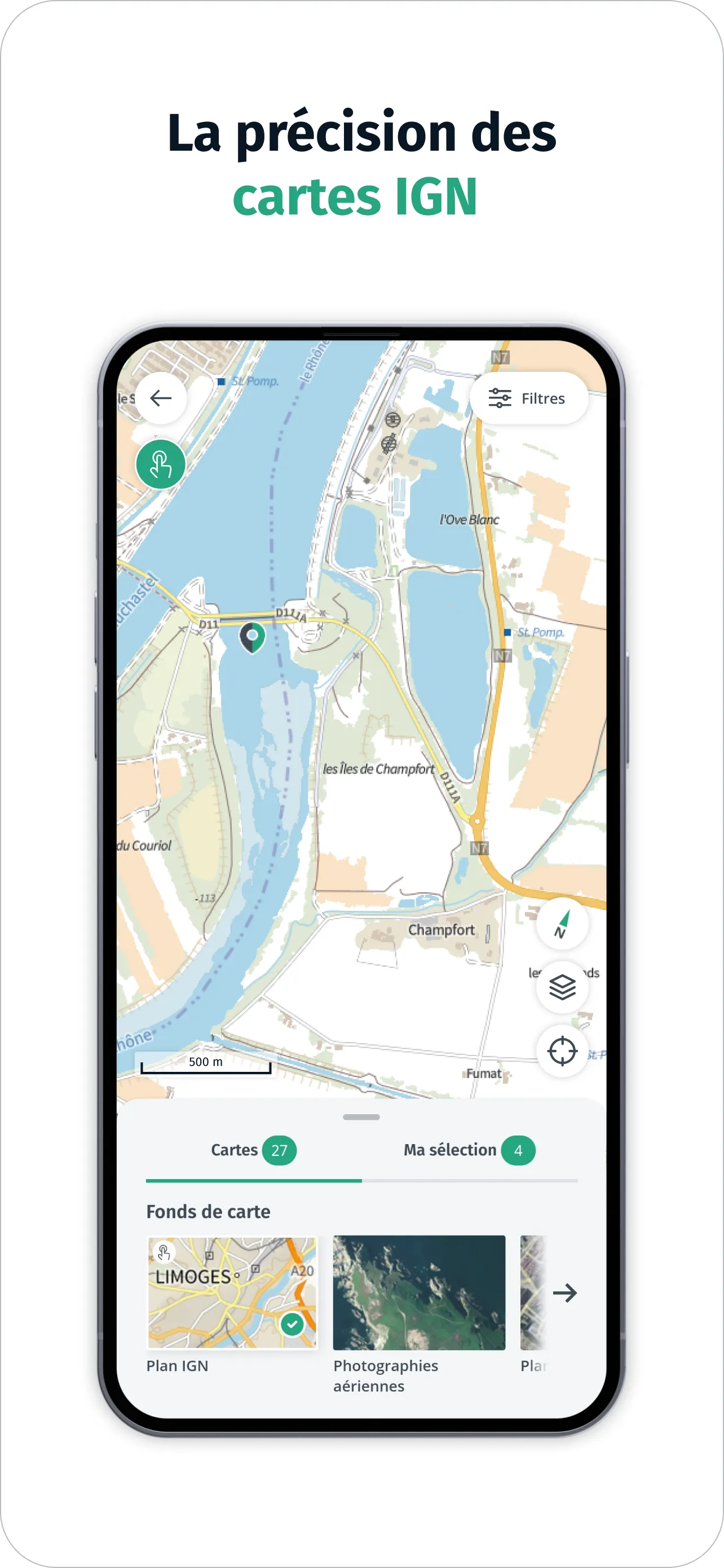
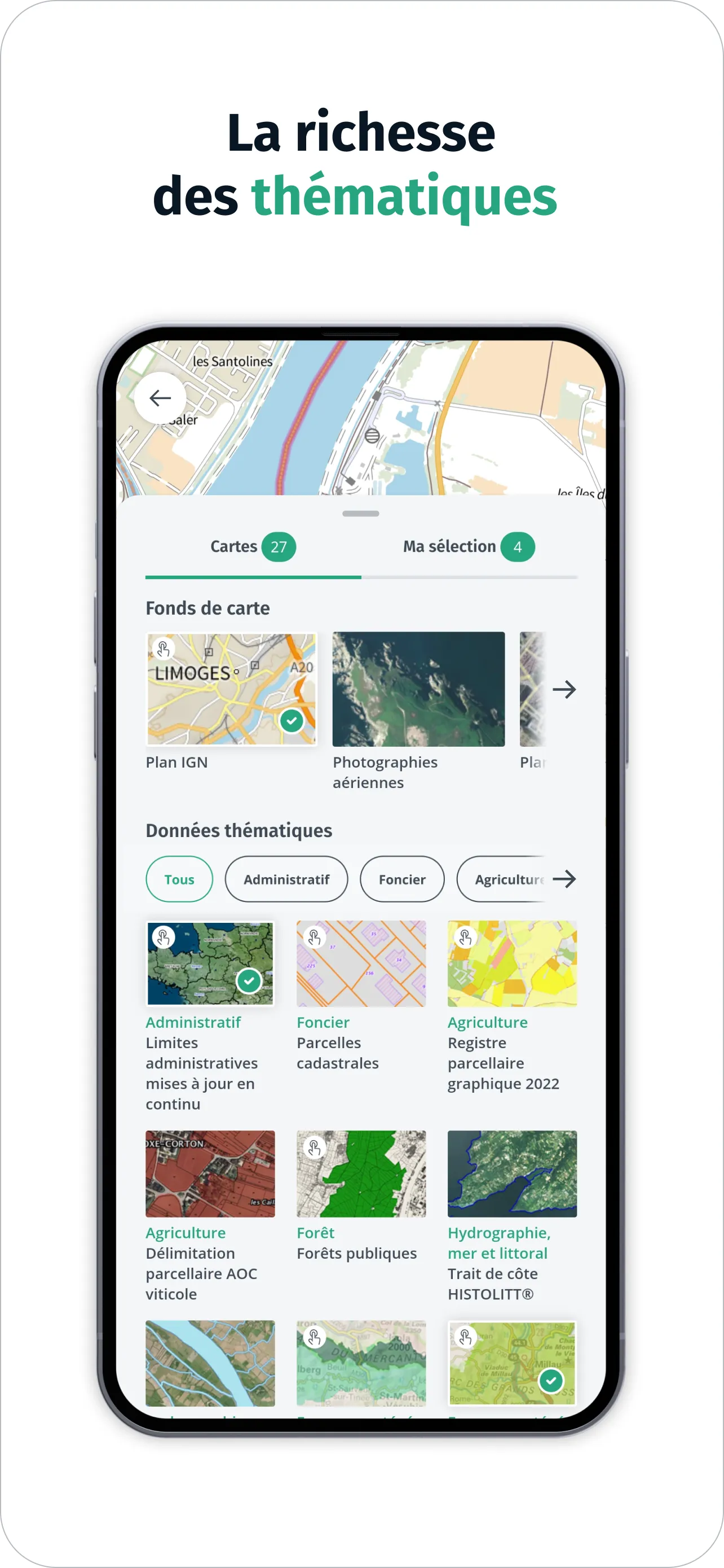
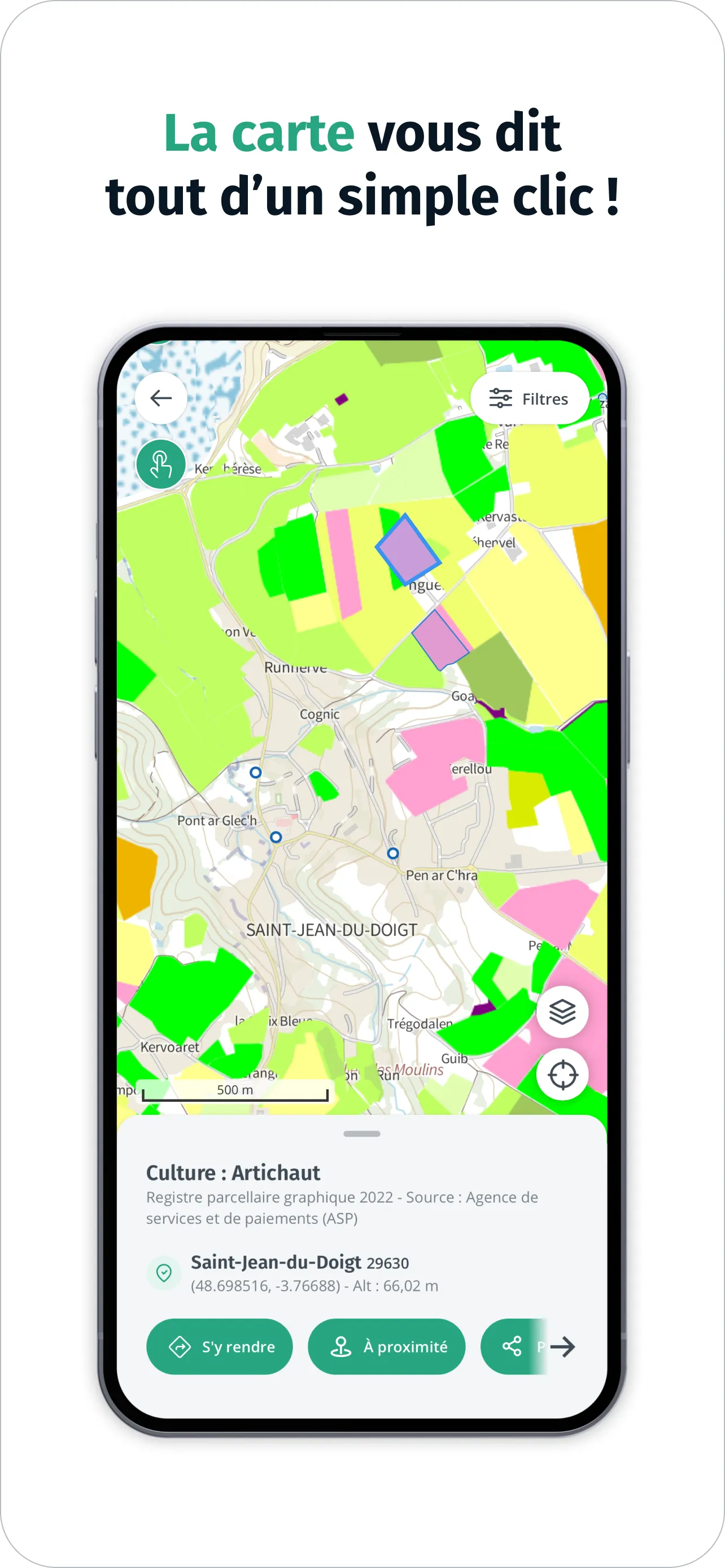
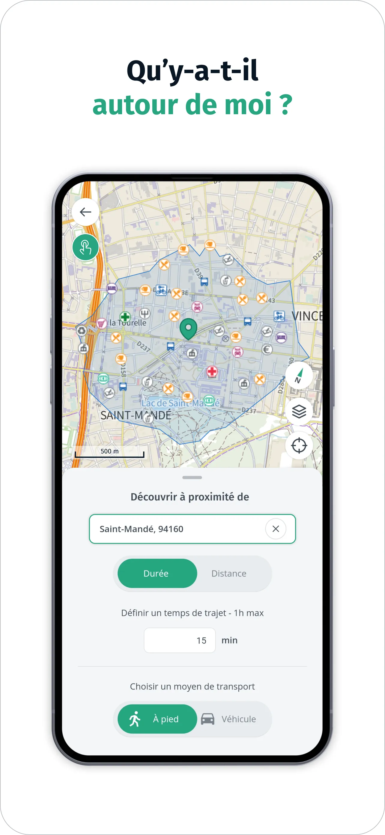
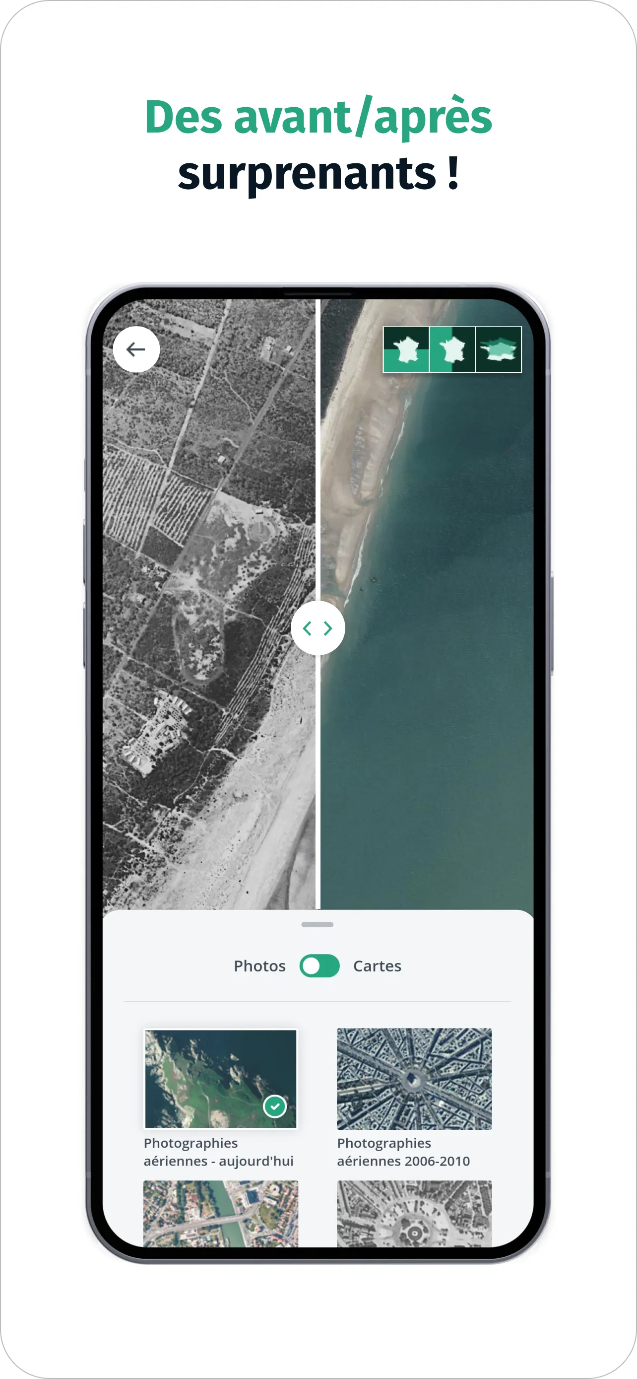
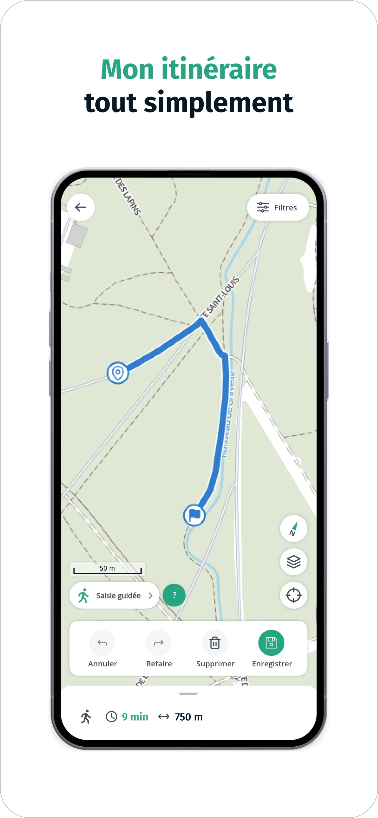
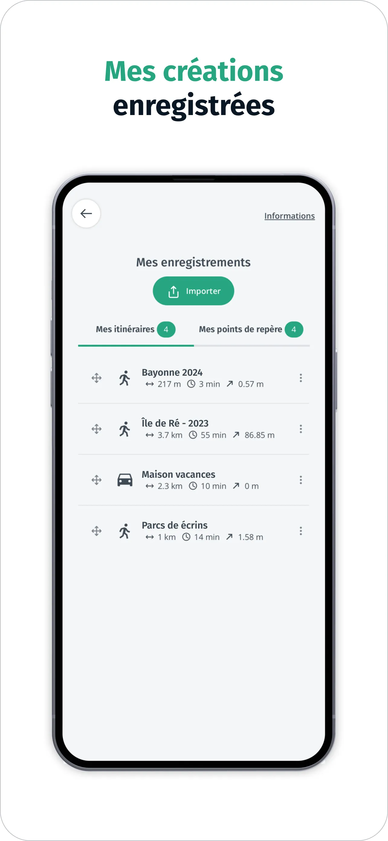
IGN Maps is the 100% free cartographic and navigation application designed by IGN, available on mobile and tablet. Find the precision of IGN base maps (IGN plan and topographic maps) combined with the wealth of thematic geographic data offered by the IGN and its partners (administrative, land, agriculture, forestry, tourism, protected areas, transport, etc.) to explore and understand the French territory. Good plan ! Click on the interactive map to obtain additional information on French territ
Developer info